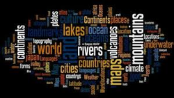
Year 8 Geography
This page lays out the topics that are taught in Year 8 Geography at Regent House. The curriculum tries to develop skills and content that are required in Geography and life and work. Transferable Skills include ICT, numeracy, literacy and decision-making. There are regular opportunities for assessment through regular homework, some of which are assessed, and through testing. There are also opportunities for fieldwork, a vital part of any Geography curriculum.
Unit 1: What is Geography and Where we Live?
In this unit pupils will learn:
* the differences between Human and Physical Geography
* human and physical Geography of Northern Ireland
* the British Isles
* the EU - countries,
* the continents and the oceans.
The pupils will be assessed through effective questioning in class, but unit scores will be calculated through assessed homework, spelling test of key words and end of unit test.
Notebook presentation must be neat and tidy and the pupils will have an opportunity to self evaluate at the end of every unit. Parents are encouraged to aid in this process and must sign the sheet at the end of every unit.
Unit 2: Mapskills
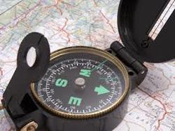
In this unit pupils will learn:
* what maps are and what they are used for
* how to give direction using compass points
* how to read 4 and 6 figure gride references
* understand map symbols
* how to read height from a map
* how to use scale
The pupils will be assessed by unit scores. Unit scores will be calculated through assessed homework, spelling test of key words and end of unit test.
Notebook presentation must be neat and tidy and the pupils will have an opportunity to self evaluate at the end of every unit. Parents are encouraged to aid in this process and must sign the sheet at the end of every unit.
Unit 3: Rivers
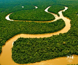
In this unit pupils will learn:
* the water cycle
* about the processes of erosion, transportation and deposition
* the features of a river along it's course
* about flooding and river management
The pupils will be assessed by unit scores. Unit scores will be calculated through assessed homework, spelling test of key words and end of unit test.
Notebook presentation must be neat and tidy and the pupils will have an opportunity to self evaluate at the end of every unit. Parents are encouraged to aid in this process and must sign the sheet at the end of every unit.
Unit 4: glaciation
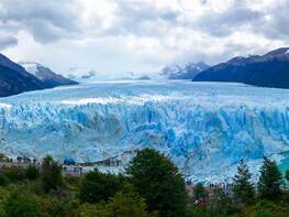
In this unit pupils will learn:
* How the last ice age affected the British Isles
* What glaciers are and how they form
* How glaciers shape the land by erosion
* How glaciers create landforms by deposition
* How to identify glacial landforms on OS maps
The pupils will be assessed by unit scores. Unit scores will be calculated through assessed homework, spelling test of key words and end of unit test.
Notebook presentation must be neat and tidy and the pupils will have an opportunity to self evaluate at the end of every unit. Parents are encouraged to aid in this process and must sign the sheet at the end of every unit.
